
Dearborn ZIP Coverage
Six ZIP designations serve Dearborn. Four are standard delivery ZIPs, while 48121 and 48123 are for Dearborn post-office boxes. A postal lookup is most accurate when it treats the designation as one part of an address, rather than as a neighborhood boundary or a list of everyone in an area. Exact delivery and municipality both need their own confirmation.
| ZIP | Areas Covered | Post Office | Notes |
|---|---|---|---|
| 48120 | Standard Dearborn delivery, with southeast and east Dearborn context | Dearborn 48120 station or label | Postal boundary does not equal the city line |
| 48121 | Dearborn post-office boxes | Dearborn 48121 postal designation | PO Box-only, not a street-area proxy |
| 48123 | Dearborn post-office boxes | Dearborn 48121/48123 PO Box designation | PO Box-only, no census-style neighborhood coverage |
| 48124 | Standard Dearborn delivery, with west and southwest context | Dearborn 48124 | Verify each address near the city line |
| 48126 | Standard Dearborn delivery, with central and east context | Dearborn 48126 | Postal and city lines can differ |
| 48128 | Standard Dearborn delivery, with west and northwest context | Dearborn 48128 | Nearby 48127 labels can cause confusion |
Use the USPS address lookup for a deliverable address and the City of Dearborn assessment or Wayne County parcel record for government jurisdiction. Neighboring 48122 is Melvindale, 48125 and 48127 are associated with Dearborn Heights, and 48193 is Riverview. Those nearby labels are not part of the standard Dearborn city ZIP set.
For a current address, write down the postal label, the city named by the parcel source, and the parcel ID before opening another record. That short record note makes it easier to spot a search that has moved from Dearborn into a nearby municipality. The parcel ID is especially useful where two streets have similar names or an old directory uses a different place label.
Six Dearborn ZIP Roles
The six labels do not describe six equal parts of the city. The two PO Box ZIPs cannot identify a residential street area at all. The four standard ZIPs are delivery areas that may approach or cross municipal edges. Postal geography is useful for an address check, a mailing label, or a same-name search, but the City of Dearborn assessor and Wayne County GIS control the parcel question.
Dearborn also sits beside Detroit, Dearborn Heights, Melvindale, Inkster, and Taylor. A record with a Dearborn-area ZIP does not automatically belong to the City of Dearborn. For a parcel, retain three keys: the USPS street, city, and ZIP; the situs or verified 911 address used by assessing and GIS; and the legal description or lot-block information used in deeds. Each key has a different purpose.
Postal geography. A ZIP code is designed for delivery routing, while a municipal boundary decides which city assesses, taxes, and keeps local parcel records.
USPS Checks for Dearborn ZIPs
USPS offers three useful modes for a Dearborn postal search. “By Address” checks a corporate or residential street address with city and state, and can also accept a street plus ZIP. “By City and State” returns ZIPs associated with a city. “Cities by ZIP” returns the city labels associated with a submitted ZIP. For Dearborn, the last two modes are useful for comparison, but the exact street query is the better test for delivery.
The USPS lookup source is shown below.
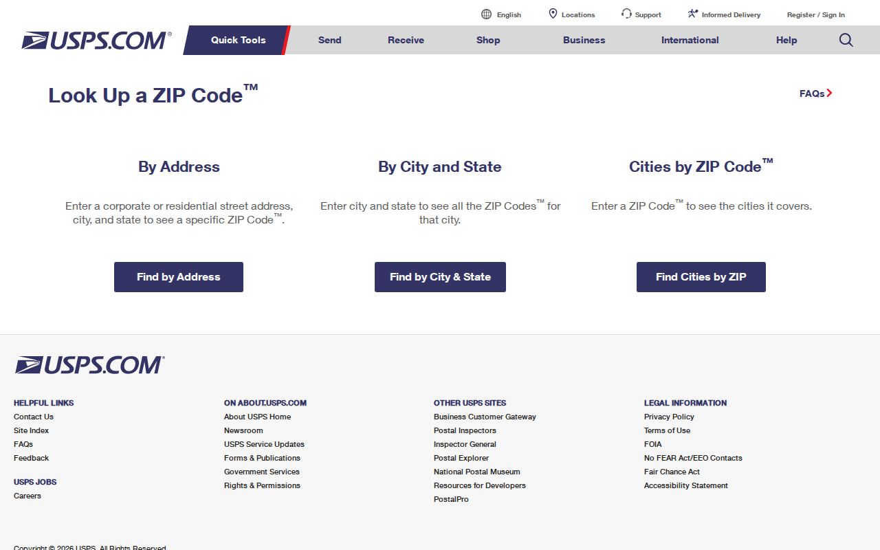
Record the five-digit Dearborn USPS result exactly. A postal city returned by USPS is not a substitute for the municipal name shown by a Dearborn parcel or tax record.
Michigan map guidance also notes that ZIP boundaries are approximate and do not coincide with Census tabulation areas. Avoid using a ZIP population estimate as if it were the count of Dearborn residents. That Dearborn comparison answers a different geographic question.
Search a Dearborn ZIP
A Dearborn ZIP search narrows the starting area, then the search must return to the full Dearborn address and parcel. The Wayne Treasurer property-tax listing and Dearborn BS&A do not document a dedicated public ZIP filter. The Treasurer uses street, parcel, and municipality fields; BS&A advertises address, name, and parcel-number searches. The Michigan Voter Information Center can use ZIP as a Dearborn personal lookup disambiguator, while a Qualified Voter File request uses government geography such as jurisdiction, district, or ward rather than a direct ZIP selection.
- Use USPS By City and State to confirm the ZIP designations associated with Dearborn, then use By Address for the exact street location.
- Search the street or parcel in the Wayne County Treasurer listing, choosing Dearborn from the municipality choices when appropriate.
- Compare the property with the Dearborn assessment database and the Wayne County parcel map to confirm the situs and parcel.
- For a lawful voter-record question, use the state’s stated process and preserve its protected-field restrictions. Do not treat a ZIP as proof of current residence.
Once a Dearborn ZIP has narrowed the area to a street, the address sequence belongs in the Dearborn street directory, where Dearborn parcel and street-level records are handled in detail.
Dearborn ZIP Search Fields
The Wayne Treasurer search is a useful ZIP-adjacent tool because it lets a searcher select Dearborn as the municipality, then work from a street or parcel. It is not a documented ZIP-search portal. Enter the street name with at least its first three letters, add a street number when known, and leave out the Street or Avenue suffix for a wider street pass. A matching property result can show the address, parcel ID, municipality, tax year, and delinquent-tax or payment information.
| Field | Format or search use |
|---|---|
| Search mode | Choose property address or parcel ID. The two modes use different fields. |
| Street number | Optional in address mode; enter one or more leading digits. |
| Street name | Required in address mode; use the first three or more letters and omit a suffix for a wider match. |
| Municipality | Optional selector that includes Dearborn and neighboring Wayne County communities. |
| Parcel ID | Required in parcel mode; non-Detroit IDs use 14 to 16 characters without spaces or dashes. |
The Wayne Treasurer property-tax search source appears below.
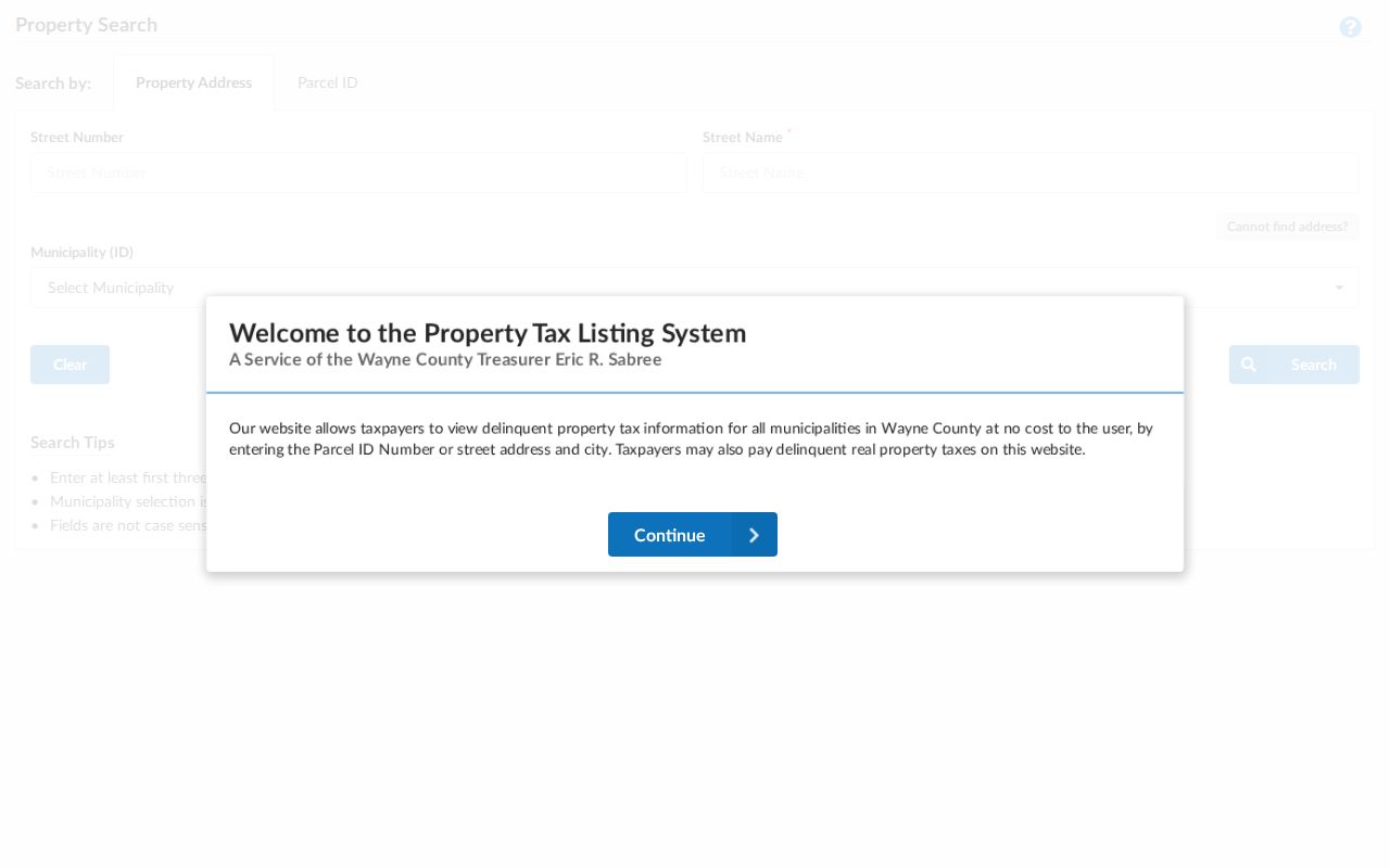
Selecting Dearborn in the municipality field prevents a nearby municipal record from being mistaken for a City of Dearborn result merely because the street or ZIP label looks similar.
Dearborn ZIP City Limits
A Dearborn ZIP boundary and the Dearborn city limit are separate lines. USPS decides how mail is labeled and delivered. The assessor, Treasurer, and parcel map determine whether a property lies in the City of Dearborn. Near Melvindale, Dearborn Heights, Taylor, or Detroit, verify the municipality before using a record from a city office. A postal address can be close enough to Dearborn to look local while the parcel falls elsewhere.
Historical records add another layer. Dearborn consolidated with Fordson on January 15, 1929, and old records can appear under Fordson, Springwells, Dearborn village, Dearborn Township, or Wayne County. A historical directory predates modern ZIP searching, so begin with its street and number. Then carry the parcel ID, lot-block detail, or legal description forward to a modern mapped address and USPS result.
Note: Keep the original place name in a historical search, because replacing Fordson or Springwells with a modern ZIP can hide a valid record.
Dearborn ZIP Key Terms
Postal and land-record terms can look alike while pointing to different things. Keep the definitions below with a ZIP note or parcel search so the address trail remains clear.
- ZIP and ZIP+4
- A five-digit ZIP identifies a delivery area. ZIP+4 adds a smaller delivery segment, not a municipal jurisdiction.
- PO Box ZIP
- A designation for post-office boxes. It does not describe a residential street service area.
- Unique ZIP
- A ZIP assigned to one large organization or destination. The researched Dearborn set identifies PO Box ZIPs, not a confirmed unique institutional ZIP.
- Carrier route
- A mail-delivery sequence used by USPS. It is not a city boundary, ownership line, or household roster.
- Situs address
- The physical property address used by assessing, GIS, permits, and many tax records.
When two records disagree, do not discard either address at once. Mark which source supplied the delivery label, which one supplied the situs address, and whether both point to the same parcel. A mailing address can belong to an owner, representative, or other correspondent, while the mapped situs identifies the land. That distinction is often more useful than a ZIP alone.
Dearborn ZIPs Before Modern Mail
City directories and census schedules are better tools for an earlier address than a modern ZIP. The Dearborn Historical Museum holds Polk directories from 1926 through 2001, including information on every Dearborn building, and its archive also keeps newspaper microfilm, yearbooks, photographs, and early city materials. The Dearborn Public Library catalog identifies Polk and Bresser city directories, though access can vary by item.
For an old address, search the directory’s street section by number first. Save the street spelling and place name as printed, then compare it with a modern parcel or plat. The legal description can remain stable even when a street label or postal practice changes. That route prevents a current postal lookup from being asked to solve an address question from a period before today’s delivery geography existed.
Old records may use Fordson, Springwells, Dearborn village, Dearborn Township, or Wayne County instead of the current city name. Compare the old street entry with a plat or legal description before trying to normalize it to a present delivery label. When the historical record contains only a number and street, the directory, parcel map, and deed description provide a more reliable bridge than a guessed ZIP.